Porters Creek Trail
Categories:

| County |
Sevier County, TN |
| Elevation |
2,600 ft |
| Latitude |
35.69696 |
| Longitude |
-83.38773 |
| Rating |
|
Approx. 2 mile hike from the parking lot (4 miles round trip).
Around 2/3 of a mile from the trailhead you will see old stone walls on the right. These walls are from the Elbert Cantrell farmstead. Cantrell lived in the Porters Creek community in the early 1900s. Nearby is teh Ownby Cemetery which has grave stones dating back to the early 1900's.
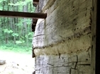
1 mile on the trail you will come to a history farm site. This was the farm site of John Messer. Here there is a cantilevered barn built by John Whaley around 1875. There is also a cabin built by the Smoky Mountain Hiking Club in the 1930's.
Nearby Geocaches
Porters Creek Trail Photos:


We sell prints of many of our photos. If you are interested you can view our gallery of photos available for purchase.
View Gallery
Porters Creek Trail Map:
Get Directions